
Sitemap
A list of all the posts and pages found on the site. For you robots out there, there is an XML version available for digesting as well.
Pages
Posts
Future Blog Post
Published:
This post will show up by default. To disable scheduling of future posts, edit config.yml and set future: false.
Blog Post number 4
Published:
This is a sample blog post. Lorem ipsum I can’t remember the rest of lorem ipsum and don’t have an internet connection right now. Testing testing testing this blog post. Blog posts are cool.
Blog Post number 3
Published:
This is a sample blog post. Lorem ipsum I can’t remember the rest of lorem ipsum and don’t have an internet connection right now. Testing testing testing this blog post. Blog posts are cool.
Blog Post number 2
Published:
This is a sample blog post. Lorem ipsum I can’t remember the rest of lorem ipsum and don’t have an internet connection right now. Testing testing testing this blog post. Blog posts are cool.
Blog Post number 1
Published:
This is a sample blog post. Lorem ipsum I can’t remember the rest of lorem ipsum and don’t have an internet connection right now. Testing testing testing this blog post. Blog posts are cool.
portfolio
Portfolio item number 1
Short description of portfolio item number 1
Portfolio item number 2
Short description of portfolio item number 2
publications
EXPLORING THE LINKAGE BETWEEN SPACE SYNTAX AND VISUAL IMPRESSION OF ARCHITECTURAL SPACES: A case study of the Japanese streetscapes during moments of ‘Oku’
Published in 14th International Space Syntax Symposium, 2024
Extend Visibility Graph Analysis (VGA) to 3D.
Recommended citation: Law, S., Kahlon, Y., Fan, Z., Gath-Morad, M., Hu, D., Shen, Y., Oki, T., Nguyen-Tran, Y.K., Murata, R., Marsatyasti, N., Fujii, H., 2024. EXPLORING THE LINKAGE BETWEEN SPACE SYNTAX AND VISUAL IMPRESSION OF ARCHITECTURAL SPACES: A case study of the Japanese streetscapes during moments of 'Oku', in: 14th International Space Syntax Symposium, SSS 2024. Presented at the 14th International Space Syntax Symposium, SSS 2024, Space Syntax Network / Sejong University Press.
Download Paper
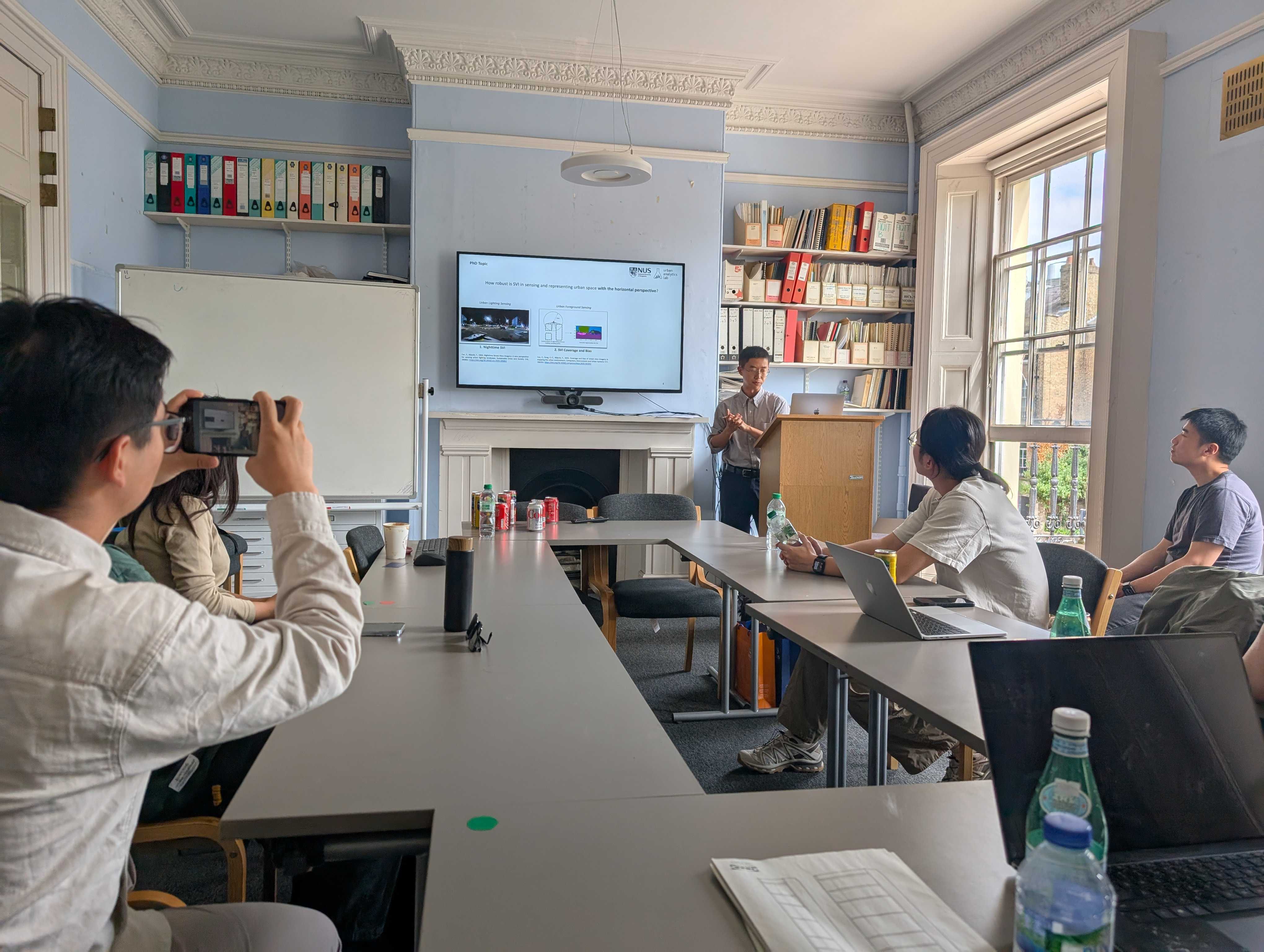
Nighttime Street View Imagery: A new perspective for sensing urban lighting landscape
Published in Sustainable Cities and Society, 2024
To what extent Street View Imagery taken during nighttime can be applied in urban research?
Recommended citation: Fan, Z., Biljecki, F., 2024. Nighttime Street View Imagery: A new perspective for sensing urban lighting landscape. Sustainable Cities and Society 116, 105862. https://doi.org/10.1016/j.scs.2024.105862
Download Paper | Download Bibtex
ZenSVI: An open-source software for the integrated acquisition, processing and analysis of street view imagery towards scalable urban science
Published in Computers, Environment and Urban Systems, 2025
An open-source Python package that integrates the entire process of SVI analysis.
Recommended citation: Ito, K., Zhu, Y., Abdelrahman, M., Liang, X., Fan, Z., Hou, Y., Zhao, T., Ma, R., Fujiwara, K., Ouyang, J., Quintana, M., Biljecki, F., 2025. ZenSVI: An open-source software for the integrated acquisition, processing and analysis of street view imagery towards scalable urban science. Computers, Environment and Urban Systems 119, 102283. https://doi.org/10.1016/j.compenvurbsys.2024.102283
Download Paper
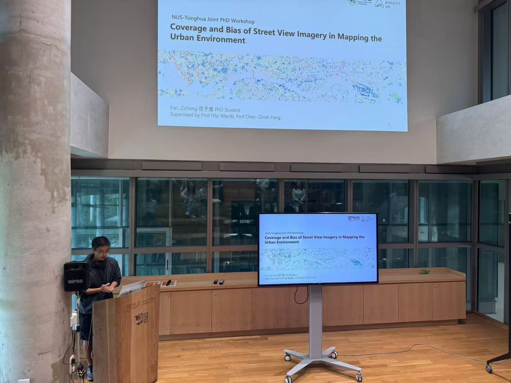
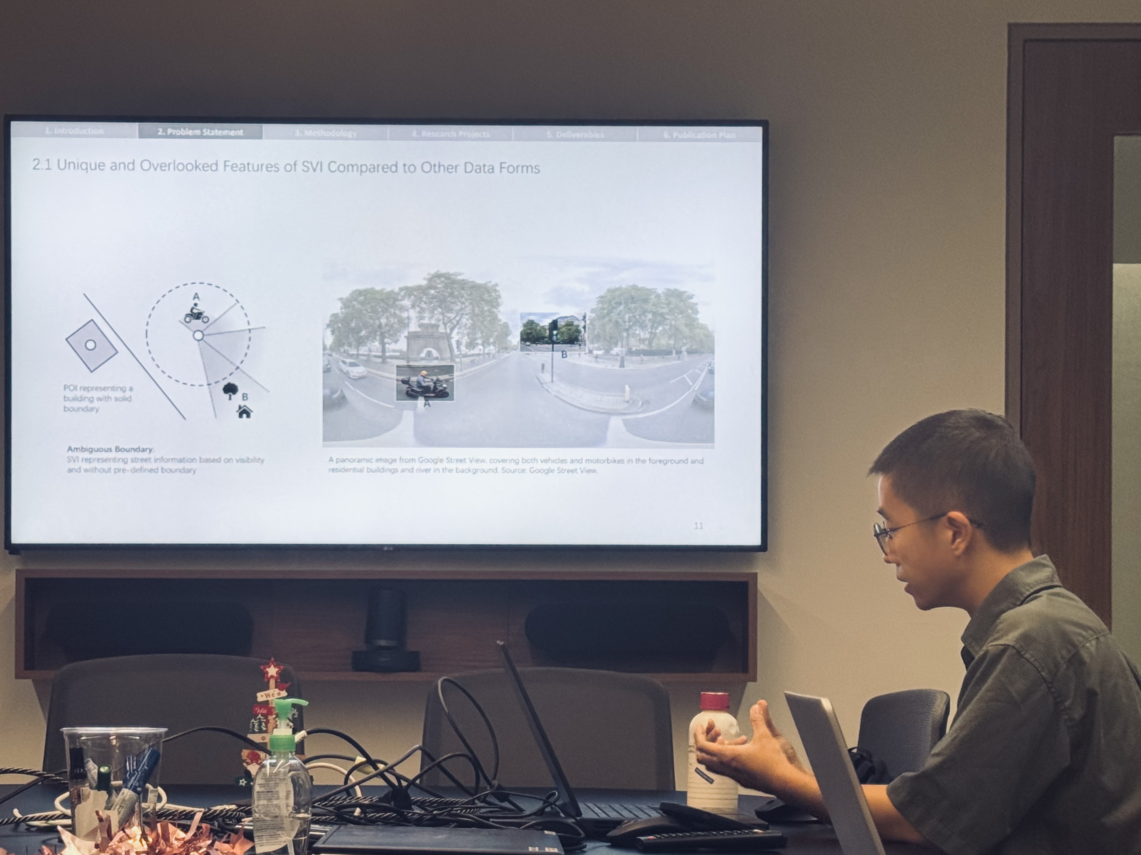
Coverage and bias of street view imagery in mapping the urban environment
Published in Computers, Environment and Urban Systems, 2025
Frequency and completeness of SVI coverage on building facades.
Recommended citation: Fan, Z., Feng, C.-C., Biljecki, F., 2025. Coverage and bias of street view imagery in mapping the urban environment. Computers, Environment and Urban Systems 117, 102253. https://doi.org/10.1016/j.compenvurbsys.2025.102253
Download Paper | Download Bibtex
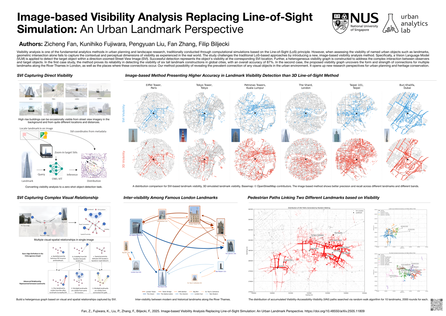
Image-based Visibility Analysis Replacing Line-of-Sight Simulation: An Urban Landmark Perspective
Published in Under Review, 2025
Can images be quantitatively applied to replace traditional LoS-based analysis, to investigate the visibility of urban objects at a large scale?
Recommended citation: Fan, Z., Fujiwara, K., Liu, P., Zhang, F., Biljecki, F., 2025. Image-based Visibility Analysis Replacing Line-of-Sight Simulation: An Urban Landmark Perspective. arXiv preprint arXiv:2505.11809. https://doi.org/10.48550/arXiv.2505.11809
Download Paper | Download Bibtex
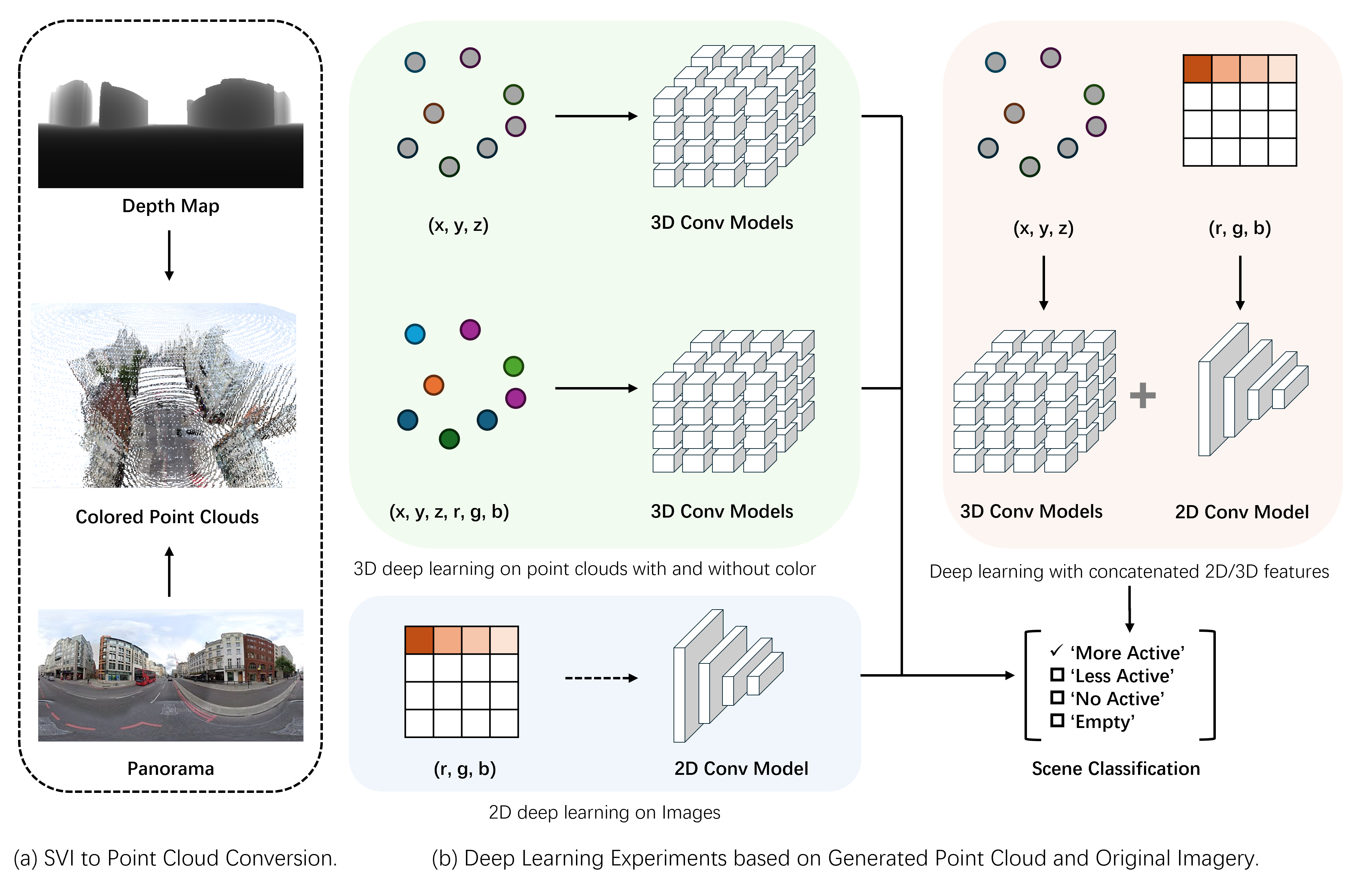
Three Dimensional Street Scene Representation Learning for Street Frontage Classification
Published in The 19th International Conference on Computational Urban Planning and Urban Management (CUPUM), 2025
Can we use 3D street morphology to infer street attributes
Recommended citation: Fan, Z., Law, S., Biljecki, F. (2025). Three Dimensional Street Scene Representation Learning for Street Frontage Classification. In The 19th International Conference on Computational Urban Planning and Urban Management (CUPUM), London, UK.
Download Paper
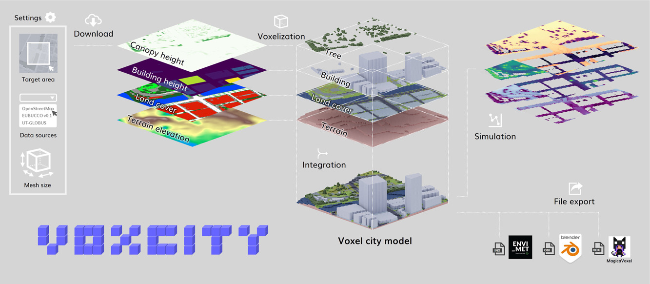
VoxCity: A seamless framework for open geospatial data integration, grid-based semantic 3D city model generation, and urban environment simulation
Published in Computers, Environment and Urban Systems, 2025
A Python package for 3D city model generation and environment simulations worldwide.
Recommended citation: Fujiwara, K., Tsurumi, R., Kiyono, T., Fan, Z., Liang, X., Lei, B., Yap, W., Ito, K., Biljecki, F., 2026. VoxCity: A seamless framework for open geospatial data integration, grid-based semantic 3D city model generation, and urban environment simulation. Computers, Environment and Urban Systems 123, 102366. https://doi.org/10.1016/j.compenvurbsys.2025.102366
Download Paper
talks
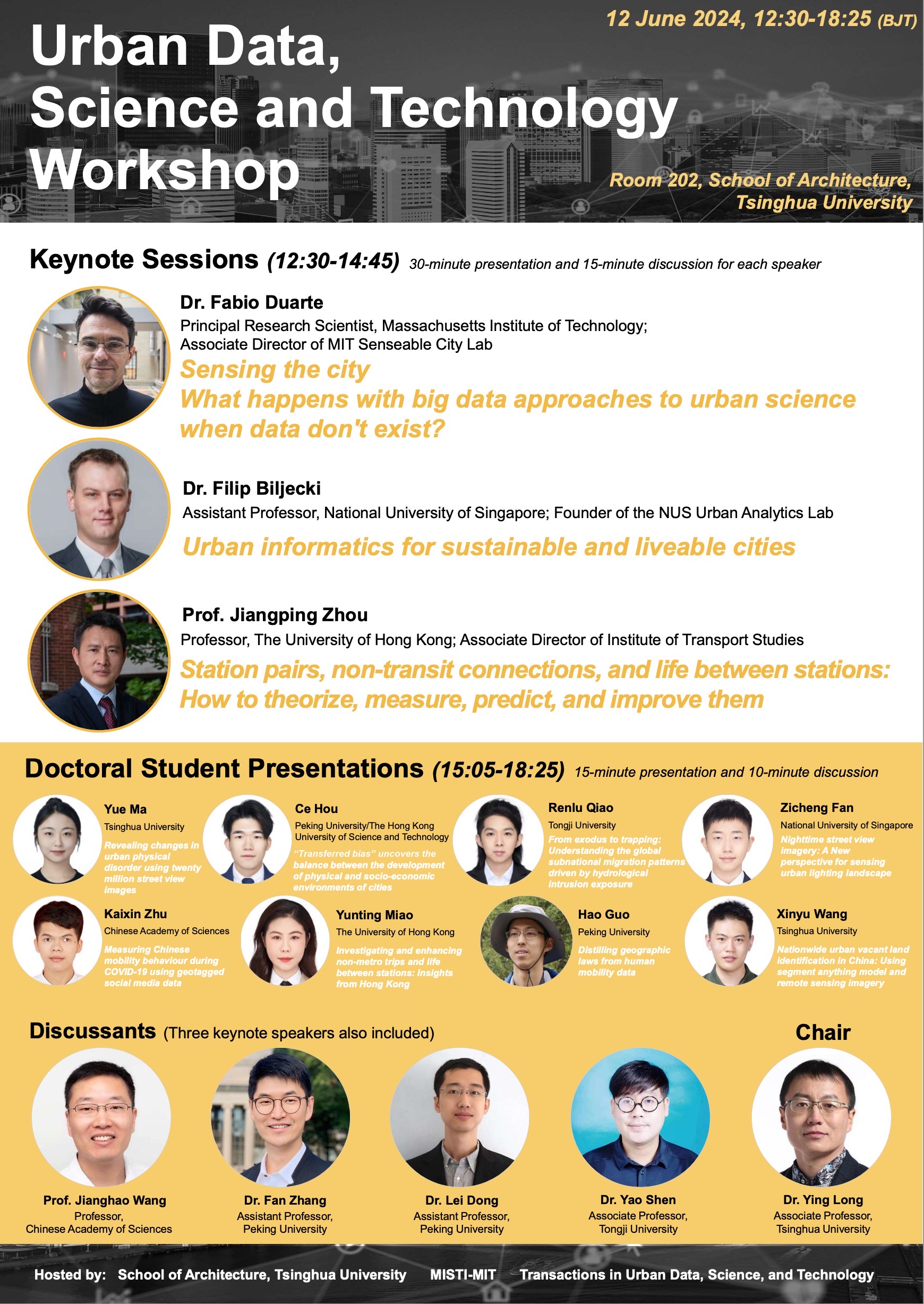
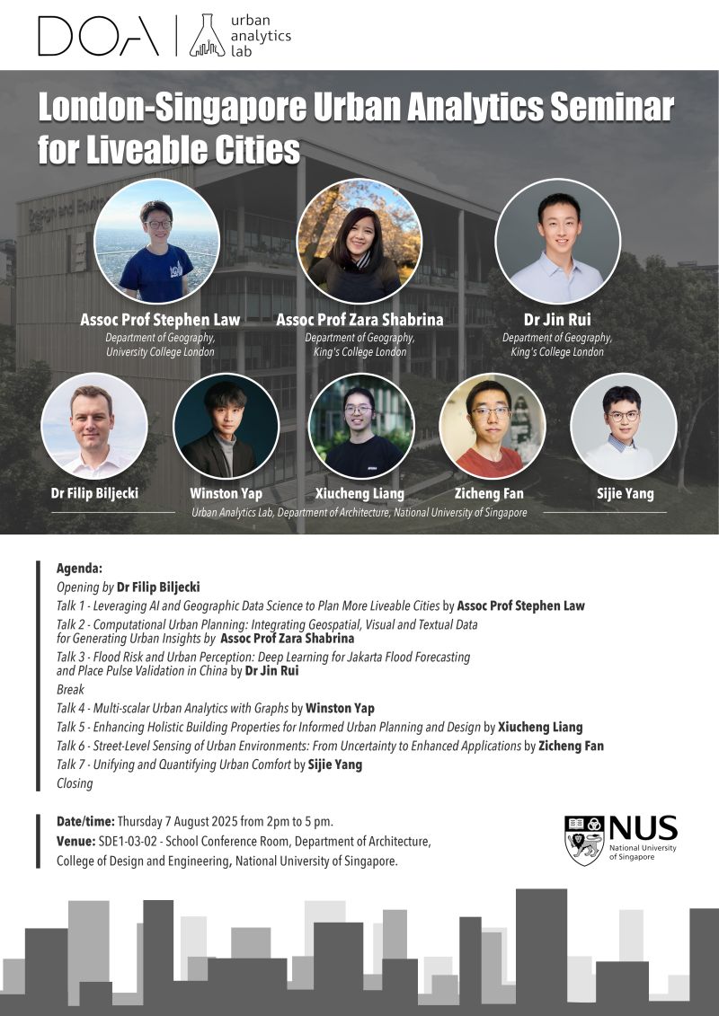
Urban Data, Science and Technology Workshop
Published:
NUS-Tsinghua Joint PhD Symposium
Published:
PhD Oral Qualifying Examination
Published:
Visiting Guest Universtiy for Presentation
Published:
teaching
Teaching Assistant - DEP5111 Planning Technologies
Postgraduate course, Department of Architecture, National University of Singapore, 0202
This graduate course is intended to MUP and Architecture students and others at the College of Design and Engineering who aspire to learn about data science in general and in the urban context, and attain basic programming skills in R. Much of it is focused on urban data and applications in the urban context. This course is composed of lectures and computer labs, providing hands-on the state of the art tools, datasets, and methods to manipulate, analyse, and visualise data. The course focuses on urban problems, but it is taught in a sufficiently generic manner so the knowledge can be transferrable to other domains.
Teaching Assistant - AR5959D Topics in Design Technology 4
Postgraduate course, Department of Architecture, National University of Singapore, 2024
R language, spatial analysis and statistics
Teaching Assistant - CDE2212 AI for Design
Undergraduate course, Department of Architecture, National University of Singapore, 2024
This module introduces you to applications of Artificial Intelligence (AI), especially with respect to the design of our environment. Application spaces may include buildings, public spaces, landscapes, dwellings, transportation nodes, and recreational areas. AI can support the designer in the design decision making process, through both analysis and synthesis. In this module you will be presented with an overview of different kinds of AI applications for design, with a partial focus on the application of an AI-based methodology for design exploration with respect to selected performance indicators, and another on the application of image-based AI techniques supporting design space interpretation.
Teaching Assistant - CDE2215 Introduction to GIS
UNdergraduate course, Department of Architecture, National University of Singapore, 2025
This course focuses on the important concepts and the practical use of Geographic Information System (GIS) in problem solving in both the social and physical sciences. Topics to be covered include vector and raster data formats and their analytical functions. This course is designed as learning through practicing, so practical laboratory excises utilising GIS software such as ArcGIS will be major classroom activities. This course is mounted for students throughout NUS with interests in GIS applications in sciences, social sciences, engineering and business analysis.